Air Pollution
And how it affects European countries and Poland
Air pollution is one of the most pressing environmental and public health issues of our time. It is caused by a variety of sources, both natural and human-made, such as vehicle emissions, industrial activities, agriculture, and residential heating. Pollutants like particulate matter (PM), nitrogen dioxide (NO₂), sulfur dioxide (SO₂), and ground-level ozone (O₃) can have severe impacts on human health, ecosystems, and the climate. Understanding and addressing air pollution is crucial for creating sustainable, livable environments.
Across Europe, significant efforts have been made to reduce air pollution, particularly since the 1990s. European Union regulations and policies, such as the Ambient Air Quality Directive, have helped improve air quality in many areas. However, air pollution remains a major concern, especially in urban and industrial regions. Despite progress, millions of Europeans are still exposed to levels of pollutants above the World Health Organization's recommended limits, contributing to respiratory diseases, cardiovascular problems, and premature deaths.
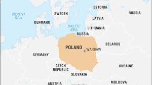
Poland faces unique challenges when it comes to air quality. Due to a combination of heavy coal use for energy and heating, dense urban populations, and geographic factors, many Polish cities frequently exceed safe levels of air pollution. In fact, several Polish cities rank among the most polluted in the EU. The main pollutants of concern include fine particulate matter (PM2.5 and PM10) and nitrogen dioxide (NO₂), which are the ones we explore in the current project.
Project General Information
This project aims to analyze and visualize the spatial distribution and concentration levels of the identified air pollutants throughout the territory of Poland. The coordinate reference system (CRS) used is EPSG:4326 - WGS 84, with coordinates expressed in degrees of latitude and longitude. This is a geographic coordinate system based on the World Geodetic System 1984 ensemble (EPSG:6326), which provides global coverage and is widely used in web mapping. The project visualization is composed of two principal parts: the description of the methodology accompanied with corresponding results of each step and the WebGIS for interactive map visualization.